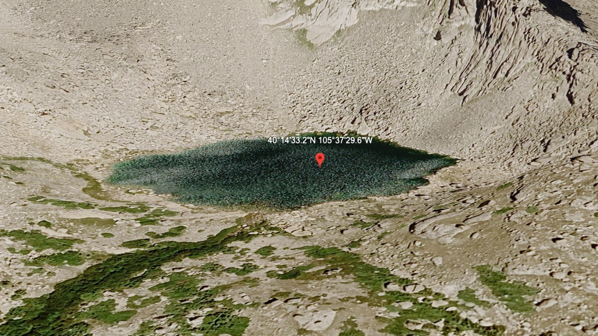
About Keplinger Lake
Keplinger Lake sits in a part of RMNP where terrain context matters: Longs Peak Area, 11,686 feet, east of the Continental Divide. This guide treats it as a hard lake.
The listed approach is 5.5 miles one-way from Longs Peak TH (off-trail), but this should be treated as a route-finding objective rather than a simple maintained-trail hike. It is an off-trail objective, and longs Peak west face. In this area, the Longs Peak area is exposed, high, and more alpine than its mileage alone suggests.
NPS notes that the Chasm Lake route is exposed for about half of the hike and that lingering snowfields can persist outside the heart of summer, useful context for any lake objective in the Longs Peak area.
🚻 Restroom available at the Longs Peak TH (off-trail) trailhead. Pit toilets in winter, flush toilets in summer.