About Lawn Lake
Lawn Lake is a hard hike in the Horseshoe Park and Lawn Lake area, sitting at 10,987 feet and 6.2 miles one-way from Lawn Lake Trailhead. It is also one of the park's historically important lake basins because of the 1982 Lawn Lake Dam failure.
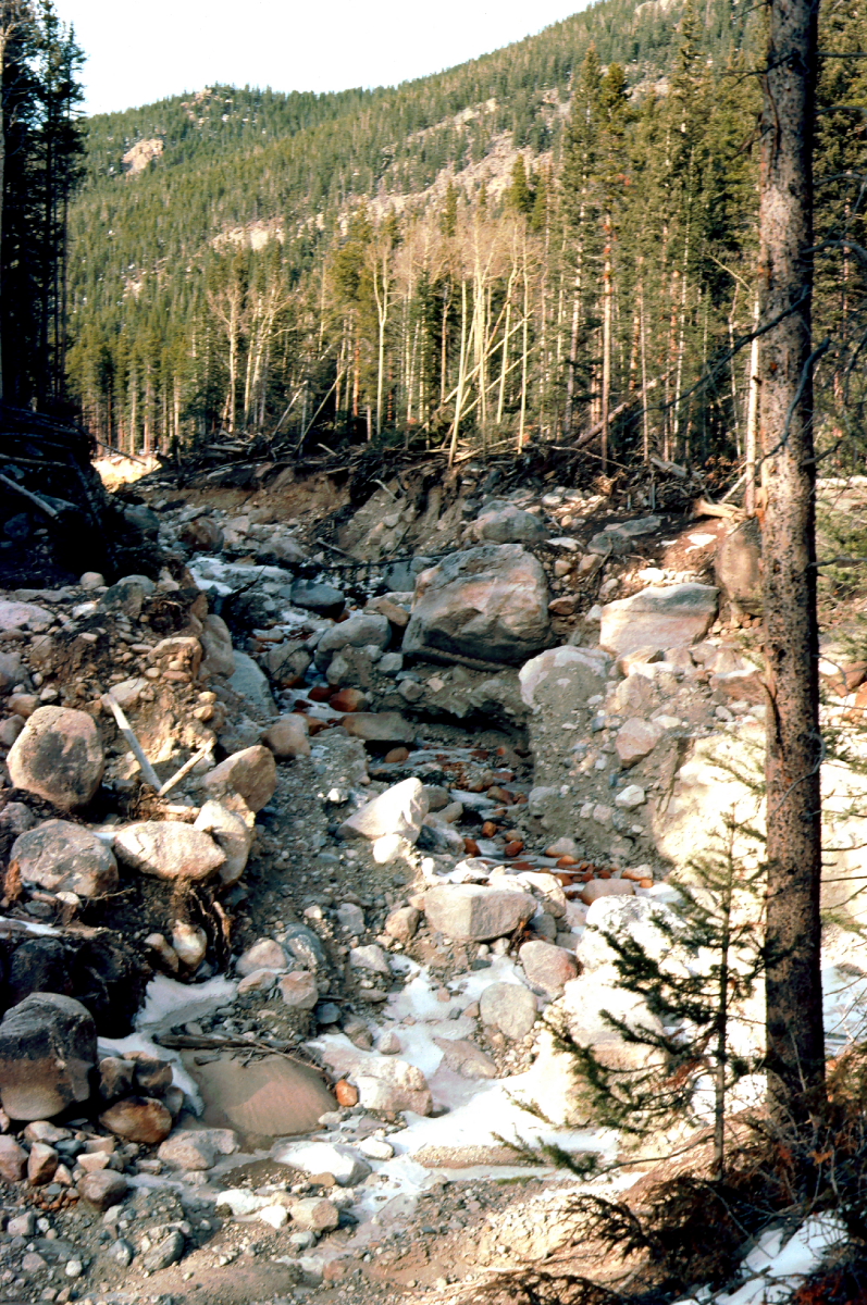
USGS and NPS accounts describe the dam failure as a major flood event on July 15, 1982, sending water down the Roaring River and reshaping parts of Horseshoe Park. Visiting the lake today means seeing a quiet alpine basin with a very real human and hydrologic history behind it.
NPS wilderness-site data also lists Lawn Lake in the Mummy Range Area: 6.2 miles from the trailhead, 2,450 feet of elevation change, an average snow-free date of June 26, and a site elevation of 10,990 feet.
🚻 Restroom available at the Lawn Lake TH trailhead. Pit toilet/privy at the parking area. No potable water.